Sold/Expired free topo maps of Shawnee Nat forest

Status
Not open for further replies.
Joined
Sep 17, 2010
Messages
4,826
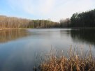
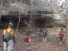
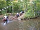
if anyone hunts in Southern Il, I have four quadrangle 1:24000 topo maps of the forest East of Vienna, Il, right around Millstone Bluff. Pope/Johnson County. Ill never use em, and if you have use, or know who does, let me know and ill send em your way.
 
Register to hide this ad
Are these printed maps or software? This is my stomping ground. My best friend lives very close to Millstone. Pic from last weekend at Jackson Falls:

1545185_10151939352454401_1739900863_n.jpg
 
MetropolisLakeOutfitters said:
Are these printed maps or software? This is my stomping ground. My best friend lives very close to Millstone. Pic from last weekend at Jackson Falls:

1545185_10151939352454401_1739900863_n.jpg
Nice! we used to get a big deer camp going in the woods by that campground for gun and archery season. I wish I still had deer camp to go to.
theyre paper.
the glendale quadrangle
stonefort quad
eddyville quad
waltersburg quad

Although Im not so sure how useful these are now with gps like it is, and google maps. Just dont like to throw stuff away
 
I'm sure I could make use of them more than anybody here, or at least know somebody who might want them so I'll take them. I actually have a set that I keep in my backpack when mountain biking there but they got really wet recently and I haven't checked them out. Can PM you an address and send a few bucks for postage if necessary.
 
pm addy, no postage necessary; I may get my hands in your pocket one of these days, lol.
 
mike cyrwus said:
Although Im not so sure how useful these are now with gps like it is, and google maps. Just dont like to throw stuff away
I can navigate at night with a topo. The google stuff without elevations is fluff in my opinion. Good to look at, not good for navigation when you really need to know where your at. GPS is useless in canyons with minimal sat coverage.

Give me a compass and a topo map any day.
 
dennishoddy said:
I can navigate at night with a topo. The google stuff without elevations is fluff in my opinion. Good to look at, not good for navigation when you really need to know where your at. GPS is useless in canyons with minimal sat coverage.

Give me a compass and a topo map any day.
We're talking about out in the middle of Shawnee too. Cell phone reception is nonexistent at the good places. Even standard GPS doesn't even work all that well in some of the old growth places with thick canopy's in the summertime. I've gotten lost there even with a sensitive GPS, had to eventually follow a creek for awhile.
 
More pics of the area from my own stash if anybody loves this place as much as I do. Places include One Horse Gap, Millstone Lake, Lake Kinkaid, Camp Ondessonk, Dixon Springs, Lake Glendale, and a super secret kayaking spot.
 

Attachments

  • big_waterfall_6415.jpg
    big_waterfall_6415.jpg
    378.5 KB · Views: 0
  • ravine.jpg
    ravine.jpg
    396.3 KB · Views: 0
  • IMG_0025.JPG
    IMG_0025.JPG
    200.8 KB · Views: 0
  • IMG_0001.JPG
    IMG_0001.JPG
    118.8 KB · Views: 0
  • OneHorseGapBluffs.jpg
    OneHorseGapBluffs.jpg
    143.4 KB · Views: 0
  • SlickrockClimb.jpg
    SlickrockClimb.jpg
    132.9 KB · Views: 0
  • Ondessonk.jpg
    Ondessonk.jpg
    97.4 KB · Views: 0
Status
Not open for further replies.
Back
Top